
As I boarded the Zion Canyon shuttle bus on that cold Wednesday morning in late November, my mind was racing back and forth: Should I hike the mild Kayenta Trail or the famous-but-strenuous Angels Landing? My grown-up kids Dea and Martin, their spouses Vincent and Claire, and my youngest son, Austin, were going to take the latter – but I wasn’t so sure. This was our second day in Zion National Park, and the day before, we had hiked the other strenuous (and equally famous) trail called The Narrows. Moreover, this came on the heels of a festive and busy week. “Do I have the strength to hike the Angels Landing and keep up with these youngsters?”
Down By The Virgin River
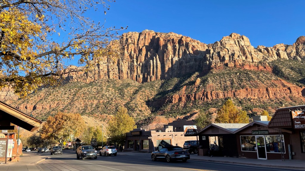
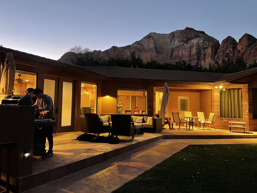
We arrived in the tiny town of Springdale in southern Utah on Monday evening. Besides the kids and me, there was also my wife Lili, plus my two sisters and their husbands, who had come all the way from Indonesia to attend Dea and Vincent’s wedding the week before. The newlyweds (pictured above) were planning to crisscross Utah for their honeymoon (or “activemoon” as they called it), and they kindly let us disturb them during the first half of the journey. After settling down in our Airbnb and hotel, we picked up our river-hiking equipment for The Narrows at Zion Guru. We topped our night with a nice pizza and pasta dinner at Zion Pizza & Noodle Co.
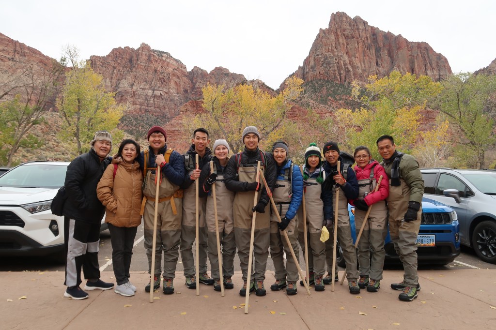
By 8 AM the next day we were already at the Zion Canyon Visitor Center parking lot. We arrived early to make sure we got parking spots and had plenty of time to hike The Narrows. After struggling to put on our dry bibs and river shoes, the eleven of us boarded the shuttle bus. “There is a 20% chance of rain at the Virgin River’s headwaters,” the friendly park ranger lady told us, “so move to the higher ground if you see the water rising!” Having seen the video of the raging flash flood in Zion last summer, we all kept this warning in mind.
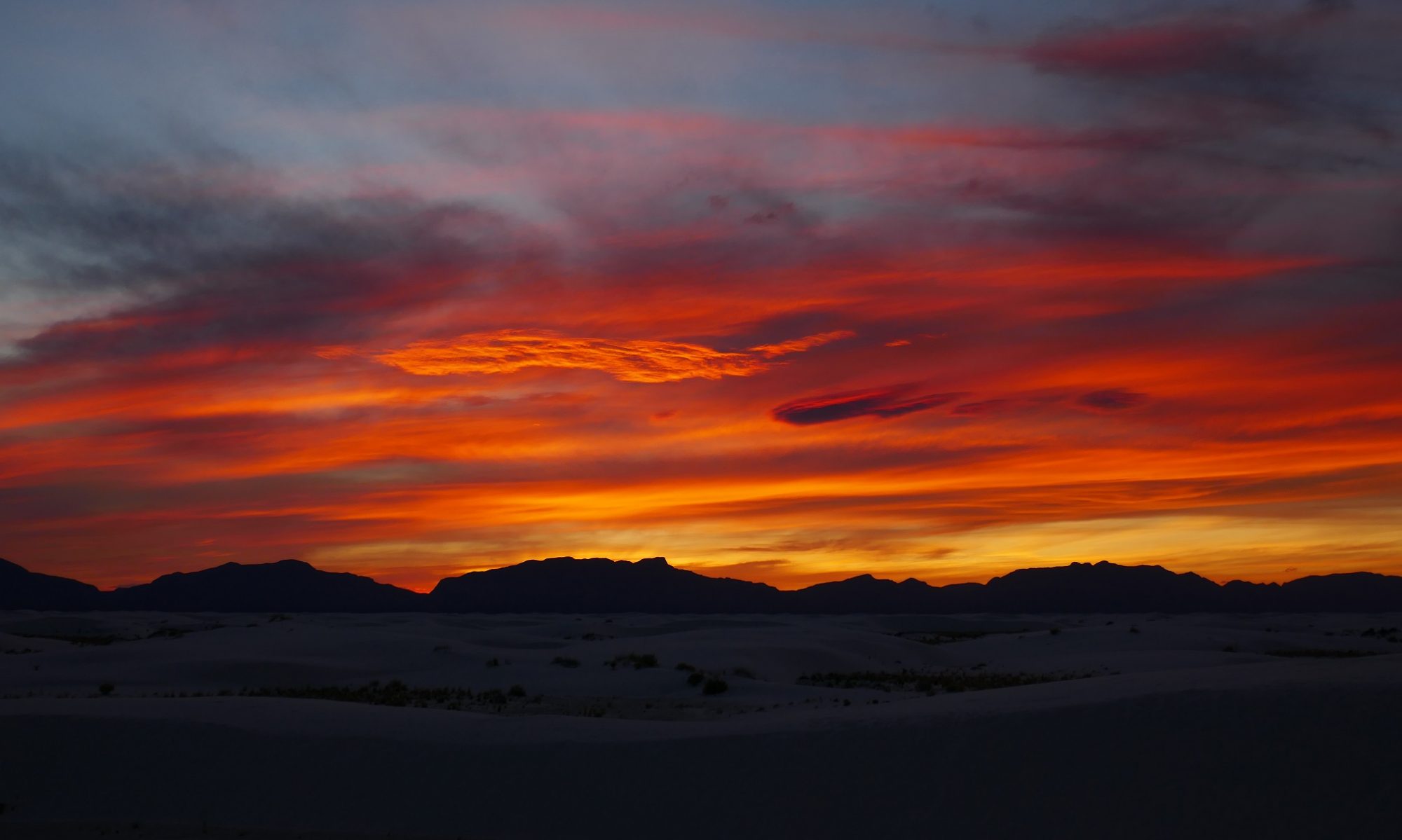
Sitting at the rear compartment of the iconic shuttle bus, we were soon mesmerized by the view along the Zion Canyon Scenic Drive. The road follows the Virgin River for about 6.5 miles (10 km), and on both sides massive rock cliffs shoot up 2,000 feet (600 m) to the sky. I had seen the pictures, but being there helped me truly appreciate the sentiment that “Zion’s unique landscape has to be seen to be believed” [1]. Along the way, the bus driver pointed out two rock climbers to us; their tiny blue specks hung against the reddish Navajo sandstone that formed the steep cliffs.

Travel Info: For most of the year, Zion Canyon (where most people visit) is closed for private cars. The only exceptions are in December, January, and mid-February (check Zion National Park website for the exact dates), or if you stay in Zion Lodge.
From May to September, about half a million visitors come every month. The Visitor Center parking lot is often full by 9 AM, and sometimes people must wait for an hour to ride the shuttle bus. But by November, the visitor number drops to half of that. We had neither trouble finding parking spaces nor long wait for the bus during our two-day visit.
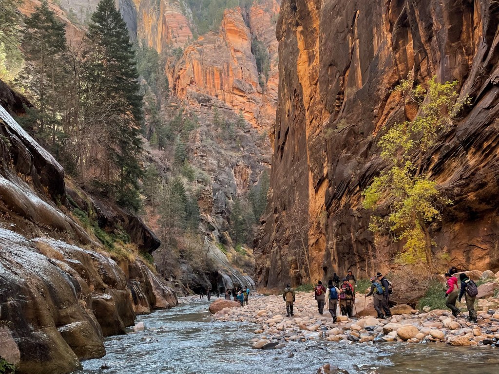
We got off the bus at the last stop known as Temple of Sinawava. From there we followed the paved and easy Riverside Walk, dotted with the late fall colors of the yellow cottonwood trees. The Riverside Walk is only 1.1 miles (1.8 km) long, but unable to resist the numerous photo ops, it took us 45 minutes to walk the undulating trail. Finally, at around 10 AM, we reached the end of the paved trail, and with it, the beginning of The Narrows.
The Narrows is unique in that it’s essentially a hike going right through a river. More precisely, it’s a half hike and half wade through the narrow canyon carved out by the Virgin River. As we walked, we were surrounded by soaring red, brown, and black rock walls that gradually closed in the further we went. Down below, the soft green color of the water is dotted with rocks of many colors.

Travel Info: The full length of The Narrows is 16 miles, and it can be hiked top down (i.e., down-river) in two days from Chamberlain’s Ranch to Riverside Walk, but it requires a permit [1, 3]. Most people hike bottom up, i.e., up-river from the end of the Riverside Walk. There is no permit required for this, and it is up to us how far we want to go before turning back. However, it is very important that we get back to Temple of Sinawava before the last bus leaves for the day. Otherwise, we’ll have to walk back 6.5 miles in the dark to the Visitor Center!
Only nine of us went ahead to hike The Narrows. My older sister and her husband had decided from the beginning that they preferred to do other leisurely strolls around the park. As for the other midlife adults in the group, I had told them, “Let’s try it. We can turn back whenever we want. The kids can go on.” In the back of my mind, I figured we would hike for about an hour before turning back.
But we really enjoyed the river hiking, and it was not as difficult as we thought it would be. Granted, we didn’t go quite as fast as the kids (who, after 50 minutes, waved us goodbye, lest they wouldn’t get anywhere far, they said), but we managed okay. The rented dry bibs, river shoes, and walking sticks certainly helped – not to mention they made us look cool in the photos.


At 11:30 AM we found a good spot for lunch. Sitting on a huge boulder right next to the river, we ate the banh mi (Vietnamese sandwich) that Dea had bought in Las Vegas the day before. Oh, there’s nothing like having majestic scenery to enhance the taste of a cold sandwich!
Stomachs full, we continued hiking for another hour. Around the Orderville Gulch junction, where there seemed to be all water and no more riverbank, we turned around and spent the next 1.5 hours walking back back to the Temple of Sinawava. Not long after, we were safely resting at our Airbnb, and the kids crashed in about an hour later. That evening, Dea and Vincent treated us to a very nice dinner at King’s Landing Bistro. Over the sumptuous steaks, we raved about our experience that day.

Up Where the Angels Land
That night, the five youngsters in our family made plans for hiking Angels Landing the next day. The folks from Indonesia announced that they wanted to recharge and enjoy Springdale, and Lili, not feeling very well, decided she wanted sleep more than anything else. That left only myself as the only one still needing to decide what to do. After short contemplation, I said, “I’ll go with the kids, but I’ll decide later whether to go up Angels Landing with them or stroll by myself along the Kayenta Trail.” As both trails start from the same place, I knew I could procrastinate my decision-making until the last minute.

Travel Info: Angels Landing has been described by Fodor’s InFocus guidebook as “much a trial as a trail” and “is one of the park’s most challenging hikes”[2]. In the Zion Information Guide pamphlet distributed by the National Park Service, only two trails are classified as “strenuous:” Angels Landing and The Narrows.
The route to Angels Landing starts at the shuttle bus stop #6, The Grotto. It first follows the West Rim Trail. In about 2.2 miles (3.5 km), it climbs 1,000 feet (305 m) to Scout Lookout, a relatively flat area on an otherwise vertical rock cliff [4]. If you imagine Angels Landing to be the top of a giant horse’s head, then Scout Lookout would be the horse’s saddle. The hike from Scout Lookout to Angels Landing is like climbing along the narrow spine of the horse neck – except that you’ll be hanging onto steel chains instead of horse mane.
As the shuttle bus pulled into The Grotto, I finally made up my mind. “I never know when I’ll be coming back to Zion,” I told the kids. “By that time, I may not be able to climb Angels Landing anymore. But Kayenta Trail, I could probably do another time.” They applauded my logic, and off we went.
It was a cold 37°F (3°C) when we started our hike, but soon, as we zigzagged our way up the West Rim wall, the sun climbed above the cliffside and blessed our trail with its warm light. We took off our jackets and pushed forward. I had to stop for breath a few times, but to my surprise, I was able to keep up with the kids. Perhaps I was simply hypnotized by the breathtaking view of Zion Canyon below or maybe the energetic attitude of my kids and other hikers rubbed off on me. Whatever it was, I felt so alive.


After 40 minutes of huffing and puffing, four of us reached the Refrigerator Canyon. Martin and Claire fell behind as Claire had to battle a fear of falling. The path along the shady and lush Refrigerator Canyon slopes gently, and for 15 minutes we were able to catch our breath. Then, the path made a 180° turn, and there came Walter’s Wiggles, a famous series of steep S curves (or switchbacks) that retested our spirit (and our leg muscles). Just as we were about to run out of breath, we arrived at Scout Lookout and were again rewarded with the majestic view of the rock formations in Zion Canyon. But as we got a glimpse of what stood between us and our final destination, we were forced to think twice about continuing on.

Travel Info: This last section of the trail (from Scout Lookout to Angels Landing) is actually only 0.5 mile (800 m) long. In that short distance, though, it ascends 500 feet (152 m) and leads hikers through a narrow, rocky path atop an exposed ridgetop. The ground drops off precipitously on both sides, deeper than hikers care to know. It is surely not for those who fear heights (and not for little kids, either).
Despite the challenge (or maybe because of it), it is estimated that 1,000 people a day hiked Angels Landing in its peak season. In 2019, the last year before the pandemic, about 300,000 people climbed it. To reduce the congestion, starting on April 1, 2022, a permit is required to hike the Angels Landing. Check NPS’ Angels Landing Permits & Hiking site for more info [5].
Following a stern warning from the kids for me “not to take crazy pictures” and “hang on to the steel chain at all times,” we braved the last half mile. I’ll have to save the details for you to experience it yourself; my words wouldn’t do it justice anyways. I’ll just say here that although it is challenging, it is doable if you are reasonably healthy, somewhat nimble, and able to withstand the heights. At times, we did have to wait for the people in front of us to move forward or for the people from the other side to descend, but it was never for too long. I found everyone so friendly and courteous; it was all “thank you,” “sorry,” and smiles. (On our way back, the trail was more crowded, and there were longer waits – but still not to an unbearable level. It was definitely a good decision to start climbing early in the day and during non-peak season.)
An hour later we reached Angels Landing. The 360° view from the top was simply heavenly. “Maybe this is the kind of view that angels see up above every day,” I thought. Vincent, Dea, Austin, and I high-fived each other, took many pictures, and soaked it all in. Then we got an unexpected bonus: Martin texted us to say that he and Claire got to Scout Landing. “Wave to us,” he said, followed by an “Oh yes, I think I can see you!”
Soon we ate lunch together on Scout Landing. It was the same exact banh mi as before (a little staler this time), but when you’re on top of the world, who cares about those details?
I wish everyone a safe and magical travel experience!

Epilogue
As I look back to our trip, one takeaway that I have is this: whatever goal we have in life, we ought to double or triple it. I thought I would hike one hour into The Narrows, but I did two and a half instead. I doubted if I had the energy to climb Angels Landing, but I managed to do it, and with a pace that matched my kids’. More importantly, on both occasions, I truly enjoyed every bit of the experience.
A month after we came back, I ordered The One Thing, a book by Gary Keller, the cofounder of Keller Williams Realty. It had been sold more than 2M copies, so I thought it would make an excellent year-end reading (it did). When it arrived, I opened the book randomly to page 93, and there it was: Think big. Avoid incremental thinking that simply asks, “What do I do next?” This is at best the slow lane to success and, at worst, the off ramp. Ask bigger questions. … Set a goal so far above what you want … [6]. Because otherwise, we’ll never know how far we can go.
Further Reading
- Lonely Planet. (2021). Zion & Bryce Canyon National Parks 5th Edition.
- Fodor’s InFocus. (2021). Zion & Bryce Canyon National Parks 2nd Edition.
- Tom’s Utah Canyoneering Guide website. The Narrows – An Overview.
- Visit Utah website. (2022). Angels Landing.
- National Park Service website. Angels Landing Permits & Hiking.
- Keller, G. and Papasan, J. (2012). The ONE Thing: The Surprisingly Simple Truth About Extraordinary Results. Bard Press, Austin, TX.
